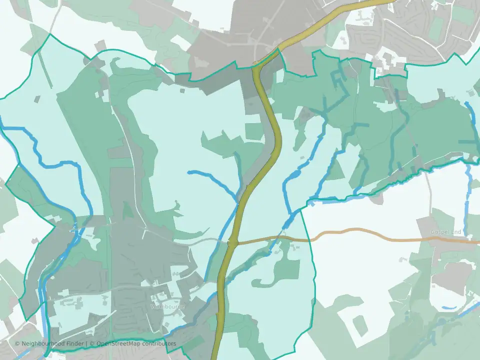
Brewood, Coven & Blymhill
Strong on schools, with transport to consider
Brewood, Coven & Blymhill at a glance
- House prices
- £305,000
- Middle53rd percentile
- Schools
- 79th percentile
- Strong
- Transport
- 16th percentile
- Weak
- Crime rate
- 50.5 per 1,000 residents
- Middle70th percentile
- Flood risk
- 4.2% of the area in flood zones
- Middle44th percentile
Underlying data dates vary by measure.
How to read these figuresIs Brewood, Coven & Blymhill a good place to live?
Brewood, Coven & Blymhill may be a good fit for people who value stronger school performance. The available data also shows the share of land in flood zones is around the middle for England. Transport access appears weaker, so those factors are worth checking against your priorities.
You can also compare nearby neighbourhoods in South Staffordshire below.
Brewood, Coven & Blymhill and nearby areas
| Area | Median sale price | Crime per 1,000 residents |
|---|---|---|
| Brewood, Coven & Blymhill | £305,000 | 50.5 |
| Codsall | £359,500 | 46.1 |
| Wombourne North | £365,000 | 57.6 |
Same sources and periods as the figures above. Each area has its own full guide.
Best fit and trade-offs
May suit
- Families who care about school performance
Watch out for
- Transport access appears weaker than most neighbourhoods nationally
Crime rate in Brewood, Coven & Blymhill
Crime rate
- Crime rate
- 50.5 per 1,000 residents
- Percentile
- 70th percentile nationally
Recorded crime is relatively lower; higher percentiles indicate lower crime.
Recorded crimes and anti-social behaviour per 1,000 residents over the 12 months to August 2026. Higher crime percentiles indicate lower recorded crime. Busy centres can show high rates because crimes are counted where they happen but divided by the people who live there.
House prices in Brewood, Coven & Blymhill
House prices
- Median sale price
- £305,000
- Percentile
- 53rd percentile nationally
House prices are around the national middle range.
Median of 60 standard sales over the 12 months to August 2026, from HM Land Registry. Lower price percentiles indicate lower prices nationally. This is an area figure, not a valuation of a particular home.
Crime by type in Brewood, Coven & Blymhill
Recorded crime by type
The largest recorded type in Brewood, Coven & Blymhill is violence, sexual offences and weapons, at 23.8 per 1,000 residents: close to South Staffordshire (28.6) and lower than England (35.9).
| Type | Brewood, Coven & Blymhill | South Staffordshire | England |
|---|---|---|---|
| Violence, sexual offences and weapons | 23.8 | 28.6 | 35.9 |
| Theft, including shoplifting | 7.0 | 6.8 | 18.1 |
| Anti-social behaviour | 5.8 | 6.8 | 10.7 |
| Vehicle crime | 4.4 | 3.6 | 5.3 |
| Criminal damage and arson | 3.3 | 4.3 | 6.8 |
| Burglary | 2.2 | 2.5 | 3.7 |
| Public order | 1.8 | 4.4 | 6.6 |
| Other crime | 1.1 | 1.8 | 2.2 |
| Drugs | 0.7 | 2.1 | 3.4 |
| Robbery | 0.4 | 0.6 | 1.5 |
Recorded crime is not the same as personal risk. How to read crime figures for an area · Check another area
Schools in Brewood, Coven & Blymhill
Schools
79th percentile nationally
Higher percentiles indicate stronger schools indicators nationally.
Flood risk in Brewood, Coven & Blymhill
Flood risk
4.2% of the area in flood zones 2 or 3
Land in Environment Agency river and sea flood zones 2 or 3. Zone 3, the higher-probability zone, covers 3% of the area. That is the 44th percentile among neighbourhoods in England, where higher means more flood-zone land. Surface water is not included, and this is not an address-level assessment: check the flood map for the specific property.
Transport in Brewood, Coven & Blymhill
Transport
16th percentile nationally
Higher percentiles indicate stronger transport indicators nationally.
FAQs
Is Brewood, Coven & Blymhill a good place to live?
Brewood, Coven & Blymhill may be a good fit for people who value stronger school performance. The available data also shows the share of land in flood zones is around the middle for England. Transport access appears weaker, so those factors are worth checking against your priorities.
Is Brewood, Coven & Blymhill safe?
Brewood, Coven & Blymhill ranks in the 70th percentile for crime data; in this dataset, a higher percentile indicates lower crime.
What are house prices like in Brewood, Coven & Blymhill?
The median sale price was £305,000 in the 12 months to August 2026. House prices are in the 53rd percentile nationally; lower percentiles indicate lower prices.
How are schools in Brewood, Coven & Blymhill?
Schools rank in the 79th percentile nationally for this public profile.
What neighbourhoods are near Brewood, Coven & Blymhill?
Nearby public profiles include Codsall in South Staffordshire and Wombourne North in South Staffordshire.